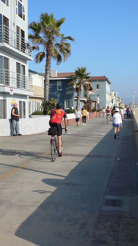
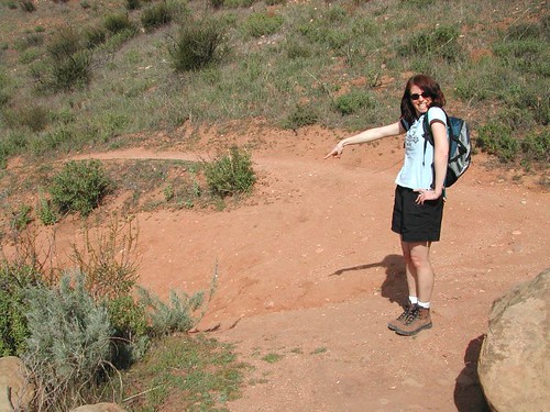
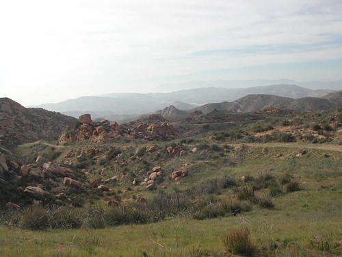
March 09, 2008

Wildwood Park (Thousand Oaks) - 8 mi 3 hr

Lots of variety... you can decide to do an easy hike, longer hike or more all of them like us.

Trailhead: From the 101, exit Lynn Road and go north, left on Avenida de Los Arboles. Follow Avenida de Los Arboles until it ends at Big Sky Drive. Make a U-turn at the park entrance is on the left side of the road.

We followed these trails in this order:
Santa Rosa Trail
Eagle Point Loop
Paradise Falls (see below)
Lizard Rock

Paradise Falls
Highlights: 70 foot waterfall, shady creek side trail, rolling hills
Distance: 3 miles round trip
Elevation Gain: 400 ft
Hike Time: 1.5 hours
Difficulty: Moderate
Trail Condition: Well maintained trail
HikeType: Loop
Summary: The first part of the trail follows Moonridge trail looking down upon Indian Creek. Trail then drops down steeply into an area if volcanic rock with a spectacular 70 foot waterfall plunging into a large pool. The return leg of the loop is an easy meandering trail along the banks of Indian creek, with a number of lovely picnic spots along the way. I promise that you will be surprised that there is such a nice setting amongst the suburban sprawl.

Also check out their website for scheduled events:
http://www.cosf.org/website/html/outings.html

February 16, 2008

San Ysidro Trail

From the trailhead...
Begin the hike on San Ysidro Trail at the sign. Stay on the trail and off of private property.
At 2 tenths of a mile, join paved road. Turn left. The trail parallels the road in some spots, or you can follow the road.

The pavement ends and the dirt road begins with a gate. Continue through the gate.
At just under the one mile mark, the trail leaves the road. The trail is marked with a redwood tree below which is a small rock marker commemorating the death of a local man. Turn right onto the trail.

At a mile and a half the trail has railings and in some spots is paved with concrete and has slippery water seepage. Then there is one large creek crossing.

At 1 and 3/4 miles there is a small side trail to a waterfall. This waterfall is a great destination spot, and after a rain it is delightful. The side trail heads straight ahead and the main trail heads to the right.

Following the main trail, head right at the junction with the side trail that goes to the waterfall. The trail becomes steeper, with switchbacks and sparser vegetation.
At just under 4.5 miles you reach the summit with East Camino Cielo Rd. It has been a relentless climb, but you are rewarded with excellent views of the city and the ocean.

To get back to the car, turn back the way you came.

Directions: 101 freeway North. San Ysidro exit. Turn right onto San Ysidro going north.
Right at East Valley Rd. (there is a shopping center with restrooms upstairs and an awesome coffee/sandwich shop where we had lunch). Pay close attention as you drive, looking for Park Lane, which is not well marked (about a minute or two on E Valley Rd. Turn left on Park Lane.
Turn left again at East Mountain Drive. Park at the end of the road. The trailhead is at the end of the road and is marked by a sign.

November 18, 2007

Lasky Mesa Loop (at Ahmanson Ranch)

Miles: 8.25
Time: 2 hours
Directions: 101, exit and right off Las Virgenes (going north). Trail starts at the end of Las Virgenes.

We've hiked and biked this trail before. Today makes the first time, however, we also ran this trail. This is our first official run for our NY Marathon training. This is our biggest goal thus far. And yes, we are CRAZY.


Great trail for running because it's a dirt trail, mostly flat. The few hills are easy to manage and the foilage provide nice scenery while you're walking/running.

For a map go to:
http://www.venturacountytrails.org/TrailMaps/AhmansonRanch/AreaHome.html

July 15, 2007

Temescal Canyon Loop - 4m 1000'

Pacific Palisades
Distance: 4 miles round trip
Elevation gain: 1000 ft
Hike time: 2 hours

This is a very popular hiking spot with great views of the ocean on clear days, a seasonal waterfall, and a densely wooded canyon. The loop starts out on Temescal Ridge Trail, climbing almost 1,000 feet in the first mile. At the intersection with Temescal Canyon Trail, you can either take a half mile side trip to Skull Rock (staying on the ridge trail) or head down into the deep Temescal Canyon. At the bottom of the canyon, you will cross a bridge with a lovely waterfall. If you are careful, you can do some rock scrambling upstream to see some additional small waterfalls. After crossing the bridge, the trail drops through the canyon at a mild pace, through a pleasantly dense wooded area.If you skipped the ridge trail, and just walked up the canyon and back, this would be a great easy 2 mile family hike.

Directions: From Santa Monica, drive north on Pacific Coast Highway (1) for 2.6 mile to Temescal Canyon Road and turn right. Drive to the end of Temescal Canyon Road and park at the entrance to the Presbyterian Conference Center. The trail head is at the far end of the parking lot on the left.

Bonus: on the way home we took PCH back to Topanga and stopped at Pat's Grill (couple miles past Inn of the 7th Ray, about a mile north of Entrada Rd where we go hiking at Trippett Ranch). Nice breakfast/lunch menu and they had someone playing guitar in back that added a nice touch.

Directions: South on Topanga Canyon Blvd. Left on PCH past Sunset. Left on Temescal Canyon Rd. (Or from Santa Monica, drive north on PCH 2.6 mile and right on Temescal Canyon Rd.) Drive to the end of Temescal Canyon Rd. and park on the street at the entrance to the Presbyterian Conference Center. Plenty of street parking available near the high school. The trial head is at the far end of the parking lot on the left.) (Lat:34.05312 Lon:-118.5286)

July 07, 2007

Topanga Overlook - 6mi 800'

Santa Monica Mtns

Distance: 6
Elevation gain: 800 feet
Hike time: 2.5 hours

We started before 9am and were rewarded with seeing a deer and 2 doe near the parking lot as we started our hike. At the top we took a break and talked with some volunteer rangers patrolling the area and keeping an eye out for fires. This is reportedly going to be the worst summer yet.

Directions: See Eagle Rock.


June 24, 2007

Sandstone Peak Loop - 6mi 1400'

Mishe Mokwa Trail, Circle X Ranch

Distance: 6 miles round trip
Elevation gain: 1400 ft
Hike time: 3.5 hours

Self portrait.

Near the top.

Start out along Mishe Mokwa Trail through grotto and unusual cliff formation, including Balanced Rock. Continue along the Backbone Trail. This fire road ascends to Sandstone Peak, then descends to the trailhead.

Directions: Exit on Westlake Blvd from the 101 Freeway, and follow it south for several miles as it merges with Mulholland highway. Turn right onto Little Sycamore Canyon and it will become Yerba Buena Road. (From Pacific Coast Highway take Yerba Buena Road about 5 ½ miles.)Proceed on Yerba Buena Road for about 4 miles to trailhead (about a mile before you hit the Circle X Ranch Ranger Station).

June 23, 2007

Runyan Canyon Loop - 3.5mi 700'

Hollywood Hills
Distance: 3.5 miles
Elevation gain: 700 feet
Hike time: <2 hours
Views of the Hollywood sign, downtown L.A., Beverly Hills, Century City and Universal City. How many different dogs can you spot on this hike? You see the hollywood starlet with dogs smaller than our cat Misto and dogs that look like they could take us. And if you have to pee we recomend the DSW on Hollywood off of La Brea.
Directions: From the top take Laurel Cyn, left on Mulholland about 2.5 miles and you'll see a free parking lot with a sign identifying Runyan Park. From the bottom take Franklin to Fuller and hope you can find street parking.

Free yoga from 10:30-11:30am in the park at the bottom.

June 16, 2007

Calabasas Peak - 4mi 1000'

Calabasas, Santa Monica Mtns
Distance: 4 miles
Elevation gain: 1000 feet
Hike time: >2 hours

Most of the way is uphill with a few chances to rest in the shade. Once you reach the top there is place to sit and enjoy the view.
Directions: Take 101, exit and go south on Topanga Canyon Blvd, right at Mulholland Dr., left at Mulholland Hwy and drive about 5 miles. Turn left at Stunt Rd and drive about 1 mile (look for the 1mile marker). Free street parking - trailhead across the street.

June 10, 2007

Eagle Rock Loop - 5mi 800'

Topanga State Park, Santa Monica Mtns
Trippet Ranch - Musch Ranch Loop

Distance: 5 miles round trip
Elevation gain: 800 feet
Hike time: 2.5 hours

The trailhead is located at the end of the parking lot by the picnic area. Follow the trail uphill a short distance to a posted junction. Take Eagle Springs Road-the left trail. 0.5 miles along this gradual uphill trail, you will pass the Santa Ynez Canyon Trail on the right. Continue on the fire road up to Eagle Rock... keep an eye out for cyclists.
Take a break at the top and check out the cave graffiti art. From Eagle Rock, return to Trippet Ranch via the Musch Ranch Trail. Take this footpath to the right as it winds down to the creek bottom through lush foliage and dense oak, sycamore, and laurel woodland. Two miles down this trail is a junction at the Musch Ranch Campground. Follow the trail sign and walk across the meadow. Turn left a short distance ahead at an unmarked junction and left again at a second unmarked junction. The trail winds back down to the Topanga parking lot.

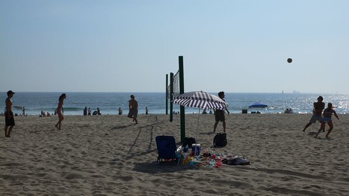
Directions: South on Topanga Canyon Blvd about 4 miles and make a left on Entrada Road. (From Santa Monica, drive 4 miles north on PCH, right on Topanga Canyon Blvd and continue 4.6 miles, make a right on Entrada Road.) Drive about 1 mile to Topanga State Park. Parking available on the street or in the parking lot for a small fee.

July 09, 2006

Biking on the South Beach

Same starting place as before- Playa Del Rey. This time we headed south past Los Angeles Airport to Redondo Beach.

Here we are posing for a photo at Redondo pier. We just enjoyed some nice cool ice cream cones, but would have preferred a beer at Naja's bar nearby if it weren't soooo hot.

The beaches were crowded this weekend. Lots of people enjoying the sun and sand.

Volleyball games were everywhere.

April 25, 2006

Mishe Mokwa/Sandstone Peak

As you can tell from the comments on Local Hikes, this is a great trail.


It's a nice solid hike, in a loop with lots of variety from tall cliffs to rolling hills. An offshoot of the loop goes to the peak of Sandstone. You can do the ascent at the begining or end of the loop depending on which direction you start out on.

There's a picnic area on the trail, so bring a snack and plan to relax.

A fog rolled in during our trip, which added some dramatic mystery to the landscape, but also blocked our views.


Here we are at the top of Sandstone.


After the hike we had a good lunch at Neptune's Net.

Here's the full photo set.

April 16, 2006

Memorial Held For Mammoth Ski Patrollers Killed

MAMMOTH LAKES, Calif. Memorial services were held for three Mammoth Mountain ski patrollers who died last week when they fell into a volcanic gas vent.

Hundreds of people crammed conference rooms at Mammoth yesterday for the 1.5 hour service honoring 37-year-old John "Scott" McAndrews, 35-year-old James Juarez and 58-year-old Charles Walter Rosenthal. Most of the resort's nearly 70 ski patrollers attended the memorial.

Authorities said McAndrews and Juarez were trying to reinforce a fence around the natural hazard when the deep snow, warmed by hot gas, collapsed and they fell into the hole.

Rosenthal died while trying to help his comrades.

Meanwhile, seven other ski patrol members who were injured trying to rescue the victims have been released from hospitals.

April 09, 2006

Eagle Rock

Back again for one of my favorite hikes.


The trailhead is in Topanga State Park. Look for Entrada Rd. off Topanga Canyon Blvd, south of Ventura towards PCH. If you're going south, it's a sharp left turn.

Take Entrada up for a few minutes and you'll see the driveway to the parking lot. Many people park on the street.

There are two ways to get to Eagle Rock. One is on more exposed fire roads (right rear of parking lot) and the other is over and through wooded areas. I like taking one out and the other back.

There are some offshoot trails worth exploring- Topanga Overlook is nice on a clear day. Santa Ynez Falls is great in the early summer. And you can connect with other trails if you want to go further.

I like the scenery, the variety of terrain, and the people. There are usually a good amount of other friendly hikers, but not too crowded unless a bus full of Cub Scouts is on the trail (which does happen from time to time).

Eagle Rock is a great place to have a snack/lunch or just relax with a great view.

February 26, 2006

Chumash Trail, Simi Valley

This weekend we went searching for a hike where Fran broke her leg several years ago. It's not particularly steep, but loose rocks combined with the distraction of nice scenery can be a nasty combination. :)

The trailhead is at the end of Flanagan Road, which is off the Yosemite exit on the 101 Freeway. You can find details about the trail on LocalHikes.com.

Here we go...

The trail is easy to walk on so you can enjoy the hike without getting lost.

Plenty of rocks & plants.

Fran points to the infamous point where she had a bad fall a couple years ago.

This group of rocks is on the right side about 3/4 mile from the trailhead. Lots of fun climbing around, and you might find a hidden object (hint: Geocache).

Fran is climbing around the rocks we found along the trail.

Marc posing on the rocks.


You can try climbing through this.


There are lots of homes being built in the area, but you can still find some great scenic shots.


Thanks to plenty of rain this season there are some nice flowers to see.


This point (the junction of the small trail to the larger one) is a 2.5 mile point.


The trail hooks up with other trails so you can hike all day if you want to.

We made it! No injuries this time. :)

February 19, 2006

Gaviota Wind Caves

We're still in the "winter storm" seasons of California (aka occasional showers and cloudy skies), which is nowhwere near what the East Coast is getting (see previous post), but does make it challenging to get out hiking.

This weekend we decided to make a break for it and drive up to Santa Barbara where we like to enjoy both walking around town and hiking in the nearby hills. I looked up www.localhikes.com and found a few good candidates. We picked the Wind Caves in Gaviota.

It's a moderate hike with great views of the surrounding hills and ocean, lots of flowers (at least this time of year) and the wind-eroded caves that give the hike its name.


Plenty of great scenery.


These are the second set of wind caves on the hike.


Inside a wind-swept cave.


The view back towards the ocean.

February 12, 2006

Runyon Canyon Again

This is one of those hikes you can keep doing over and over and not get tired of it. I had just flown back from the East Coast where a major snow storm was in full swing.

Here's what was going on in Plymouth Meeting, PA.


This was taken the same day I arrived in LA, on the Runyon Canyon trail.

That's the Hollywood Sign in the far distance.

This is downtown LA, but you can't really tell because it's engulfed in smog.

You can start up in the hills or at street level. I usually start at the top. To get there you take Mullholland from Laurel Canyon. The street trailhead is on Fuller St (near Highland).

October 23, 2005

Ahmanson Ranch after the fires

I took a quick visit to Ahmanson Ranch, two weeks after the wildfires. Here are some photos of the destruction. These were taken with my Nokia 6820 phone. Check out my previous posts to see what this area looked like before.