Throughout our trip, we stopped at the numerous visitors centers for advice on what to see and help making reservations. This is a brilliant way to make sure you make the most of your time.
One thing we were interested was the
Tongariro Crossing in Tongariro National Park. It’s a hike that takes you between three volcanoes, with incredible views along the way. But at every visitor center, we were told “Oh, it’s too late in the season. The weather is really bad now. Too dangerous, etc. etc.”
However, partly because this is a once in a lifetime experience, and partly because we had been through probably the worst weather imaginable on a hike down from Mount Whitney (and partly because we are kind of stubborn when we get “no” for an answer), we continued to drive on anyway.
We arrived that night at the
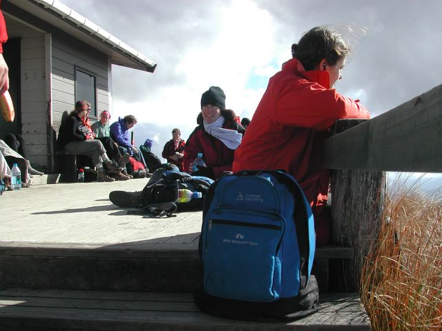
Tongariro Nat'l Park Backpackers lodge. The guy at the front desk said that two other parties had booked a ride to the trailhead for the Crossing, and were planning to go as long as the weather wasn’t too horrible. So we added our names on the list, had dinner at the tavern next door, and went to bed hoping for a good day.
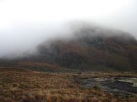
The next morning it was a bit cloudy and foggy, but no rain or wind. We decided to go for it. The bus from the lodge dropped us and the other two groups off at one end of the trail, and will pick us up at the other end later in the day. This is a one-way trip!
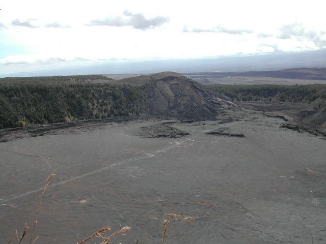
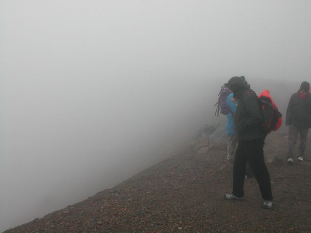
The route takes you between Mt Tongariro and Mt Ngauruhoe, a total of 17km (about 10.5 miles). The highest point is 1886m (6187.7ft) at Red Crater. But unfortunately we didn’t see Red Crater or much of anything else. The fog was so dense, you could barely see 20 feet ahead. And as we went up the wind gusts grew so strong, you had to struggle just to stand up. It was like a hurricane up there!
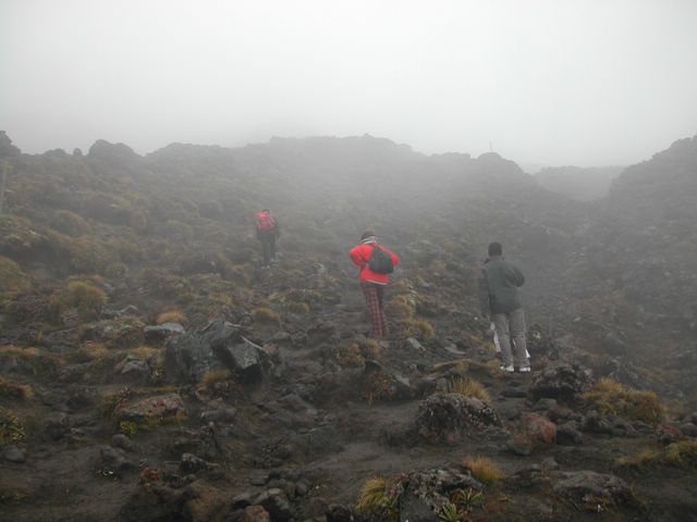
 We're going up into THAT?
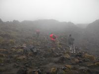 Watch your step!
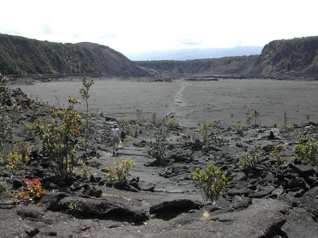
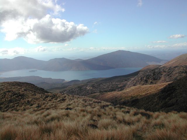
Eventually the fog did burn off as the sun started to shine through. But that was after we passed the two volcanoes. We did see some cool lakes and a view of the surrounding area. My camera battery ran out suddenly and someone commented it was the fumes from the volcanic activity that affected the battery.
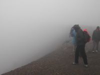 There's supposed to be a crater here...
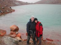 The fog cleared just in time to take this snapshot.
 After passing through the volcanic zone, we paused at Ketetahi Hut for a rest, then started on the long winding path descending to the car park where our bus would be waiting for us in a couple hours.
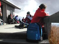 Relaxing at Ketetahi Hut.
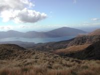 This side of Tongariro is much nicer.
By the way, in New Zealand, what we call “
Hiking” is called “
Tramping.”


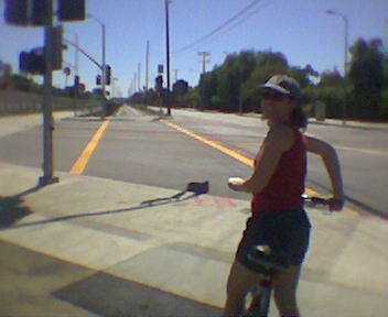
 The weather was great, so we went back again to the Santa Monica Beach Trail. This time we started at the north end where we hadn't been before. This trail and others are at www.labikepaths.com.
 We started pretty far up the trail and hit the end pretty quickly (near the southern tip of Malibu). So we turned around and went down to Venice Beach and back again. There are a lot of people in Santa Monica and Venice, so it can get pretty crowded on the path.
 The next day we drove up Pacific Coast Highway to the Ventura Coastal Bike Path. It starts at San Buenaventura State Beach and ends at Hobson RV Park. Total distance is about 25 miles. You can find this and more on the Ventura County Get There by Bike page.
 Along the way we stopped to watch some parasailers, which was really cool. We also made a pit stop at Faria Park for drinks and snacks. There's a little shop there that has sandwiches, candy, soda, etc.
 The City of LA has been working on the new Metro Orange Line for some time now. It's a 14 mile bus route with its own road that spans the entire San Fernando Valley from Warner Center to North Hollywood. The Busway isn't officially opened yet. The official first day is Oct 29, 2005.