July 09, 2006

Biking on the South Beach

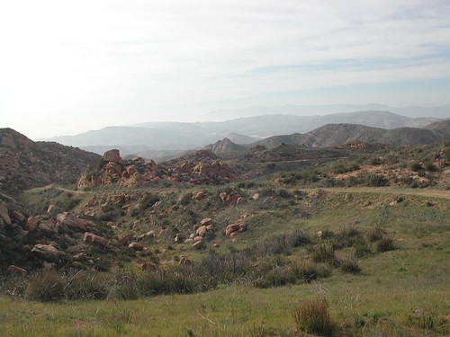
Same starting place as before- Playa Del Rey. This time we headed south past Los Angeles Airport to Redondo Beach.

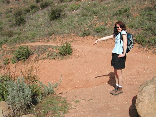
Here we are posing for a photo at Redondo pier. We just enjoyed some nice cool ice cream cones, but would have preferred a beer at Naja's bar nearby if it weren't soooo hot.

The beaches were crowded this weekend. Lots of people enjoying the sun and sand.

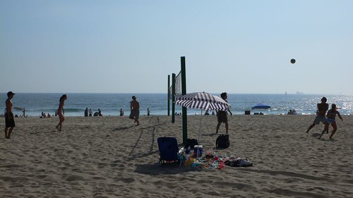
Volleyball games were everywhere.
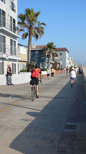
April 25, 2006

Mishe Mokwa/Sandstone Peak

As you can tell from the comments on Local Hikes, this is a great trail.


It's a nice solid hike, in a loop with lots of variety from tall cliffs to rolling hills. An offshoot of the loop goes to the peak of Sandstone. You can do the ascent at the begining or end of the loop depending on which direction you start out on.

There's a picnic area on the trail, so bring a snack and plan to relax.

A fog rolled in during our trip, which added some dramatic mystery to the landscape, but also blocked our views.


Here we are at the top of Sandstone.


After the hike we had a good lunch at Neptune's Net.

Here's the full photo set.

April 16, 2006

Memorial Held For Mammoth Ski Patrollers Killed

MAMMOTH LAKES, Calif. Memorial services were held for three Mammoth Mountain ski patrollers who died last week when they fell into a volcanic gas vent.

Hundreds of people crammed conference rooms at Mammoth yesterday for the 1.5 hour service honoring 37-year-old John "Scott" McAndrews, 35-year-old James Juarez and 58-year-old Charles Walter Rosenthal. Most of the resort's nearly 70 ski patrollers attended the memorial.

Authorities said McAndrews and Juarez were trying to reinforce a fence around the natural hazard when the deep snow, warmed by hot gas, collapsed and they fell into the hole.

Rosenthal died while trying to help his comrades.

Meanwhile, seven other ski patrol members who were injured trying to rescue the victims have been released from hospitals.

April 09, 2006

Eagle Rock

Back again for one of my favorite hikes.


The trailhead is in Topanga State Park. Look for Entrada Rd. off Topanga Canyon Blvd, south of Ventura towards PCH. If you're going south, it's a sharp left turn.

Take Entrada up for a few minutes and you'll see the driveway to the parking lot. Many people park on the street.

There are two ways to get to Eagle Rock. One is on more exposed fire roads (right rear of parking lot) and the other is over and through wooded areas. I like taking one out and the other back.

There are some offshoot trails worth exploring- Topanga Overlook is nice on a clear day. Santa Ynez Falls is great in the early summer. And you can connect with other trails if you want to go further.

I like the scenery, the variety of terrain, and the people. There are usually a good amount of other friendly hikers, but not too crowded unless a bus full of Cub Scouts is on the trail (which does happen from time to time).

Eagle Rock is a great place to have a snack/lunch or just relax with a great view.

February 26, 2006

Chumash Trail, Simi Valley

This weekend we went searching for a hike where Fran broke her leg several years ago. It's not particularly steep, but loose rocks combined with the distraction of nice scenery can be a nasty combination. :)

The trailhead is at the end of Flanagan Road, which is off the Yosemite exit on the 101 Freeway. You can find details about the trail on LocalHikes.com.

Here we go...

The trail is easy to walk on so you can enjoy the hike without getting lost.

Plenty of rocks & plants.

Fran points to the infamous point where she had a bad fall a couple years ago.

This group of rocks is on the right side about 3/4 mile from the trailhead. Lots of fun climbing around, and you might find a hidden object (hint: Geocache).

Fran is climbing around the rocks we found along the trail.

Marc posing on the rocks.


You can try climbing through this.


There are lots of homes being built in the area, but you can still find some great scenic shots.


Thanks to plenty of rain this season there are some nice flowers to see.


This point (the junction of the small trail to the larger one) is a 2.5 mile point.


The trail hooks up with other trails so you can hike all day if you want to.

We made it! No injuries this time. :)

February 19, 2006

Gaviota Wind Caves

We're still in the "winter storm" seasons of California (aka occasional showers and cloudy skies), which is nowhwere near what the East Coast is getting (see previous post), but does make it challenging to get out hiking.

This weekend we decided to make a break for it and drive up to Santa Barbara where we like to enjoy both walking around town and hiking in the nearby hills. I looked up www.localhikes.com and found a few good candidates. We picked the Wind Caves in Gaviota.

It's a moderate hike with great views of the surrounding hills and ocean, lots of flowers (at least this time of year) and the wind-eroded caves that give the hike its name.


Plenty of great scenery.


These are the second set of wind caves on the hike.


Inside a wind-swept cave.


The view back towards the ocean.

February 12, 2006

Runyon Canyon Again

This is one of those hikes you can keep doing over and over and not get tired of it. I had just flown back from the East Coast where a major snow storm was in full swing.

Here's what was going on in Plymouth Meeting, PA.


This was taken the same day I arrived in LA, on the Runyon Canyon trail.

That's the Hollywood Sign in the far distance.

This is downtown LA, but you can't really tell because it's engulfed in smog.

You can start up in the hills or at street level. I usually start at the top. To get there you take Mullholland from Laurel Canyon. The street trailhead is on Fuller St (near Highland).